


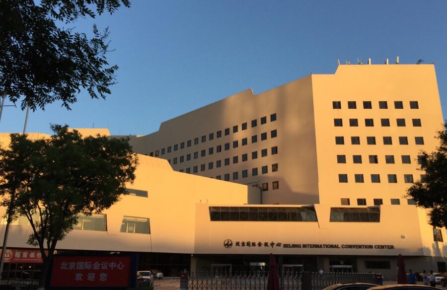
From 30th October to 1st November, the 2019 GIS Software Technology Conference will be held at the Beijing International Convention Center. With the theme of “Geo-intelligence, Deep Evolution”, the conference will focus on the evolution of new technologies, new ideas, and new models, share the international latest research results and innovative solutions of GIS, conduct peak dialogues, and jointly explore new trends in the development of industry with leaders and experts from government agencies, research institutes, universities and enterprises in countries and regions around the world.

The role of GIS in Digital China and the opportunity and challenge of AI.

In addition to the image recognition, more possibilities of GIS and AI.

The breakthroughs of Cloud Native GIS.
The evolution of the new 3D GIS and WebGIS.

What is the Video GIS?
The interpretation of the rules and ideas of natural resources informationization.

The interpretation of the prospect of BIM+GIS.
The deep integration of GIS platform software and the core products of Huawei and Ali.
30 October 8:30-17:30
Morning
Afternoon
Digitalization is changing the world and the traditional world cognition. In the era of rapid development of information and network technology, how can big data, IoT, cloud computing and intelligent manufacturing solve the digital transformation? How to build a more intelligent design, production, operation and management system to improve product quality while reducing costs? How can the digital economy derive a more shared and open economic ecosystem to promote high-quality development? How to achieve sustainable development through digital intelligence? What important improvements have been made in the field of digitalization in surveying, mapping and geographic information in the past decade? What are the problems that still remain unsolved?
With the rapid development of information technology, the Party Central Committee attaches great importance to informationization, which has become an important way to improve the government's governance ability and modernization of governance level. In the new era of socialism, what opportunities and challenges are natural resource informationization facing in fulfilling the duty of "Two Unifications"? This report will elaborate the focus and the development trend of natural resources informationization.

Alibaba Group’s Mission is “To Make it easy to do business anywhere”, while Alibaba Cloud intelligence persists in promoting business value through technology and innovation. Alibaba attaches great importance to the field of geographic information, so what has Ali done in this field? What substantial progress has been made in cooperation with GIS manufacturers?

After the hot technologies of cloud native, big data and so on, what is the evolution of GIS technology with the support of AI technology? In addition to more and more AI-integrated GIS algorithms, can the technical system of AI GIS be further constructed? What is the relationship between AI GIS and GeoAI? What are the new developments of cross platform GIS technology to support the informationization needs under the new situation?

Dassault Systèmes’ strategic collaboration with SuperMap will ensure a digital continuity and integrate GIS (Geographic Information System) into a CIM (City Information Modeling) system to reinvent and develop the future of cities. SuperMap will promote GIS, and DS will provide our key solutions for urban planning, urban management and urban simulation through the 3DEXPERIENCE Platform.

Huawei announced its Wotu Developer Program 2.0 with an investment of USD 1.5 billion in the next 5 years in this September, and signed a large number of ecological partners through Wotu digital platform, which is one of the ecological troika of Huawei. What value will this platform bring to ICT eco-partners? What role does GIS play in this platform? How to help the development of smart city and digital China with the integration and innovation of GIS and ICT?

The cloud and big data technology have been widely used in various industries, and new demands are emerging. It has been one year since the cloud native GIS technology released, how does it bring users a faster, more stable and more intelligent experience? What kind of new data engine can drive the extremely fast processing of big data GIS? How to make AR real scene navigation indoor maps and road data with a mobile phone? Deep principle analysis, various user stories and live demonstrations will help you find the answers in this report!

What is the position of Unicom Big Data? What are the six data capabilities of it? Based on the operator signaling location data, how can Unicom Big Data provide data decision basis and enable industry applications with the support of GIS and data technology, as well as the insight of people’s behavior?

Under the background of Digital Twin and real 3D construction of China, what progress has the new 3D GIS made in technological innovation and cross border cooperation? How to use distributed technology to realize efficient whole process management of large-scale real 3D data? How does the Standard of Spatial 3D Model (S3M) solve the problem of 3D data sharing? What breakthroughs have been made in the visualization effect of the 3D WebGL technology favored by GIS application developers?

Mirae & Seohae Energy is a well-known energy company that specializes in supplying city gas to parts of central Korea. Why has Mirae & Seohae Energy newly migrated its existing GIS system to SuperMap in 2018? How does GIS guide city gas companies to manage pipeline networks and facilities in 3D?

In response to the new demand for digital “twin cities”, how to build a global leading digital city with the ability of deep learning? With the integration and evolution of BIM+GIS, how to use the cutting-edge technology to serve the whole life cycle process of human-centered urban design, construction, management and operation? Let’s see the case of Xiongan New Area.
Director of Aperigae,from Turkey
Manager of IT Division in KFS,from Korea
Vice President of International Cartographic Association
Owner and CEO of Barthauer Software GmbH (from Germany)


 No.8 Beichen East Road, Chaoyang District, Beijing